History and Facts of the City of Caruthersville
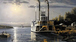
Caruthersville, the county seat of Pemiscot County, lies deep in Missouri's bootheel on the Mississippi River. The word "Pemiscot" comes from a Native American word meaning "liquid mud". Native Americans inhabited the land around Caruthersville before European settlers came; they were part of the civilization that built huge earth mounds throughout the Mississippi Valley. One such land mass remains, rising 270 feet above sea level about four miles southwest of Caruthersville. It stands in sharp contrast to the surrounding delta-like plain.
John Hardeman Walker and George W. Bushey laid out the town of Caruthersville in 1857. The town was named to honor Sam Caruthers, who first represented the area in Congress. The City of Caruthersville was incorporated on May 18, 1874.
In 1893, Missouri's General Assembly created the Saint Francis Levee District to alleviate that part of the Saint Francis basin lying within the counties of Dunklin, New Madrid and Pemiscot. This act authorized taxes for the purpose of building, repairing, protecting and maintaining levees in the district.
Sterling Price Reynolds (1861-1968), a highly regarded citizen of Caruthersville, devoted his working life to draining the swamps in the Saint Francis Levee District and protecting the city from flooding. He created the Little River Drainage District which helped turn the bog laden area into rich cotton producing soil. Eventually Reynolds became Chief Engineer for the Saint Francis Levee, a position he held until his retirement at age 101. Caruthersville paid tribute to him at that time by dedicating a park in his honor.
In February 1969 construction began on a bridge across the Mississippi at Caruthersville. Completed in 1976, it is the only bridge to cross the Mississippi River between Cairo, Illinois and Memphis, Tennessee.
Since incorporation, Caruthersville's administration and citizenry have made a determined effort to make the city a progressive community, while enhancing the quality of life for everyone.
Interesting Facts
- In 1898, Gayoso, the first county seat, was being threatened by the caving river banks. An election was held, and Caruthersville was voted the county seat. All records were moved here in 1899.
- Since clearing the swamplands, the area has changed names three times. First, it was La Petite Prairie; later, it became known as Lost Village; and today, is now Caruthersville.
- One of Caruthersville's most unusual features is that it is bordered on the North and the East by the Mississippi River.
- Although it is no longer being used to supply the City of Caruthersville with water, the "Lighthouse" water tower remains a symbol of the city's vision, civic development and history.
- On June 2, 1899 lights were brought into the area with a great ceremony from the plant of the Purl Ice, Coal and Electric Lighting Company. A large crowd assembled at the opera house and dancing went on until midnight.
- In the early 1930's and 40's the American Legion Fairgrounds was the site of much excitement when the Caruthersville Pilots, a farm team for the St. Louis Cardinals baseball team, played at home.
- Every year in the 1930's and 40's President Harry S. Truman made a visit to Caruthersville to attend the American Legion Fair. His visits were documented in Life Magazine.
- In May of 2007, Caruthersville celebrated its Sesquicentennial Birthday.
